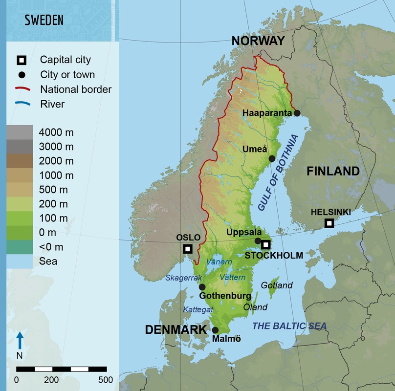
21.1 Swedish geography
 Sweden in Finland's best-known neighboring country.
 The nation's surface area is 450 000 km², which means that it is larger than Finland. Approximately 9 % of the Swedish surface area is covered by water.
Like Finland, Sweden is known for its many lakes. There are almost 100 000 lakes with a surface area larger than one hectare in Sweden. This number is almost twice as large as the number of lakes with a size of one hectare or larger in Finland. The best-known Swedish lakes are the large Vänern, Vättern and Mälaren.
The southern parts of the nation are located inside the temperate broadleaf and mixed forest zone. Because of this, the changes of the seasons are easily visible between the lush and green summer and the barren winter. Because the soil of the broadleaf forest zone is for the most part rich in nutrients, large regions of Southern Sweden have been converted for agricultural use.
The Scandinavian mountains or the Scandes are mostly located in Norway but also overlap the border of Sweden in many places. The nation's highest point, Kebnekaise, is 2 111 meters tall. This means that it is approximately 800 meters higher than the Finnish Halti.