3.5 Eskers
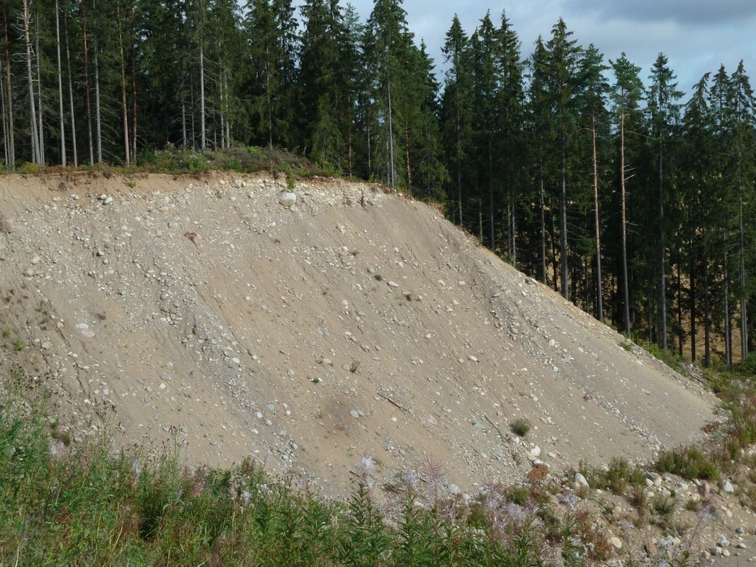
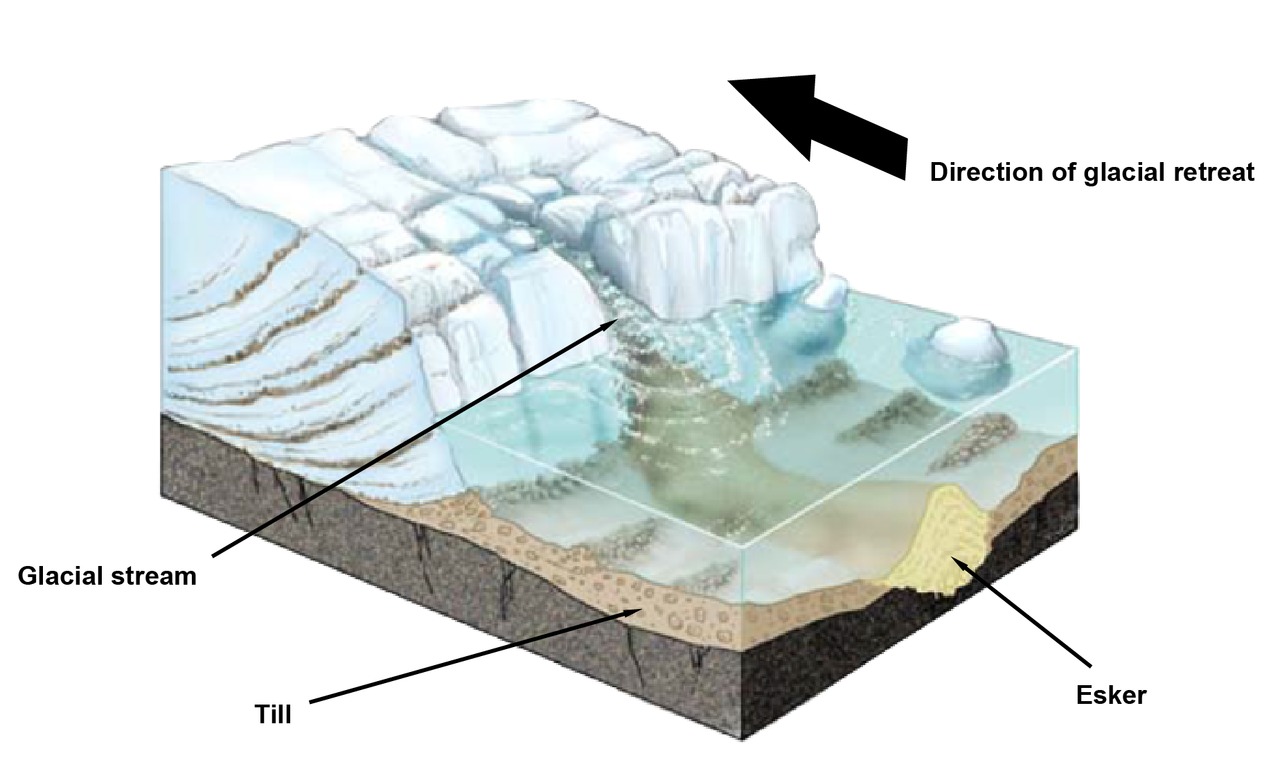
As the glacial ice retreated towards its northwestern origin, strong streams of melting water formed rivers inside and on top of the ice sheet. These glacial streams carried various kinds of rock materials with them. These materials were then smoothed and layered by the force of the water. This till or moraine is what formed the Finnish eskers. It consists of alternating layers of sand and gravel.
When the edge of the continental glacier retreated towards the northwest, the esker deltas continued to form near its edge. This is how the eskers formed long, continuous series. Eskers are usually several kilometers long and tens of meters high. The largest eskers were formed when till accumulated between two sheets of ice.
The largest esker in Finland is also the largest gravel esker in the world. It is called Pyynikinharju, and it is located in Tampere, between the lakes of Pyhäjärvi and Näsijärvi. It is 82 meters tall..
Eskers are one of the most instantly recognizable features of Finnish landscapes. They are also important spots for groundwater collection and recreation. However, many eskers have been gradually destroyed by construction and gravel collection. Nowadays, eskers are protected by strict regulations concerning gravel collection and construction on their slopes.
 An esker in Jokioinen. This esker has been used as a source of sand and gravel.