14.2 The map of Africa
Africa is a long continent. In total, it covers an area of approximately eight thousand kilometers north and south of the equator.
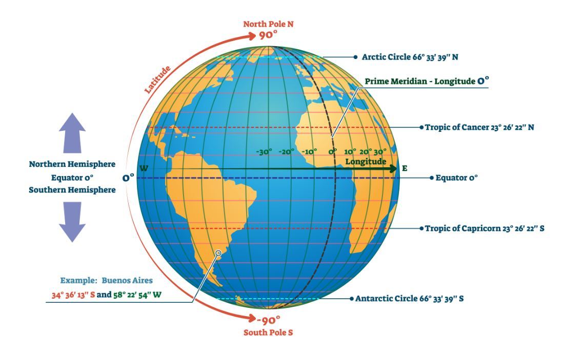
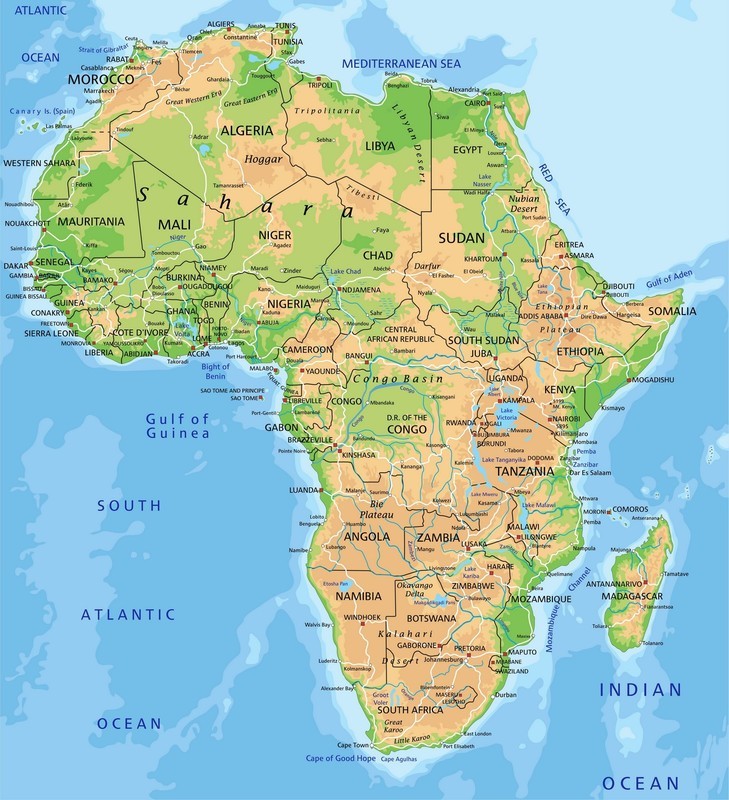
The equator runs through the middle of the African continent. The Tropic of Cancer crosses through North Africa, whereas the Tropic of Capricorn runs through the southern part of the continent.

Africa is bordered by the Mediterranean Sea in the north, the Atlantic Ocean in the west, and the Indian Ocean in the east.
 Africa consists mostly of highland regions, but it has no great mountain ranges. Lowland areas are found near the equator. The African rainforests are mostly concentrated to these lowland areas.
Africa does not have a great number of large lakes. The largest African lake is Lake Victoria, which is located on the border between Tansania and Kenya. However, the continent does have a large number of rivers. The most significant African rivers are the Nile and the Congo.
 Seterra
The equator runs through the middle of the African continent. The Tropic of Cancer crosses through North Africa, whereas the Tropic of Capricorn runs through the southern part of the continent.

Africa is bordered by the Mediterranean Sea in the north, the Atlantic Ocean in the west, and the Indian Ocean in the east.
 Africa consists mostly of highland regions, but it has no great mountain ranges. Lowland areas are found near the equator. The African rainforests are mostly concentrated to these lowland areas.
 Africa does not have a great number of large lakes. The largest African lake is Lake Victoria, which is located on the border between Tansania and Kenya. However, the continent does have a large number of rivers. The most significant African rivers are the Nile and the Congo.
There are almost 50 independent nations in Africa. Their borders are mostly carried over from the period of European colonial rule. During the 19th and 20th centuries many European nations used African regions as colonies. The purpose of these colonies was to produce raw materials for the European economies. The borders that were drawn during this era are, for the most part, still in place today.
The largest African nations in terms of their surface area are Algeria, DR Congo and South Africa.
You can practice the names, locations, flags and capitals of the African nations on Seterra.The largest African nations in terms of their surface area are Algeria, DR Congo and South Africa.